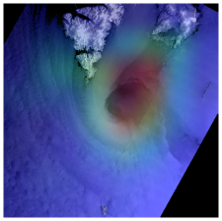
SAR processing: Synthetic Aperture Radar (SAR) is a radar that uses microwaves to image the earth's surface. The spatial resolution of a radar image is among other things depending on the size of the radar antenna. A SAR uses advanced computing to provide better spatial resolution than the physical dimensions of an antenna would suggest. However, this requires advanced signal processing technology and advanced processors. NORCE is at the forefront of research in the field and makes SAR processors for both ESA and national players. A further development of the SAR technique is interferometric measurements (InSAR), where phase shifts in the received signal are used to measure small movements and displacements in the earth's surface with millimetre accuracy. We develop InSAR processing systems and visualization tools that contribute to operational mapping services. NORCE has e.g. developed the national system for measuring ground movements (INSAR.NGU.NO) and is now working with partners to develop a similar system at European level. Contact persons: Temesgen Gebrie Yitajew, Yngvar Larsen
Machine learning: Artificial intelligence has taken an important role also within the fields of satellite remote sensing and earth observation. NORCE has solid competence on contemporary methods from machine learning, such as deep neural network architectures, reinforcement learning and computer vision algorithms. We combine theoretical knowledge on these methodologies with practical experience with earth observation applications. Our strength is the ability to combine methodological expertise with domain knowledge from earth observation. This enables us to design new methods and solutions that are adapted to the problem and incorporate prior knowledge of the underlying physics. Examples of tasks where we have used deep learning include ship detection, vegetation mapping, avalanche detection and prediction, and offshore wind estimation. Contact person: Stian N. Anfinsen
Space debris: Space debris is man-made objects in space that no longer serve any purpose. They span sizes from entire launchers to dust particles, and there are hundreds of thousands of such objects in orbit around the earth, even if we only count objects from one cm and upwards. As they move at extremely high speeds, even small particles carry a large amount of energy, and collisions with such particles pose a danger to all human activities in space, both manned and unmanned. At NORCE, we develop technology to monitor space debris using radar instruments. Such monitoring is important to avoid collisions that could destroy active satellites and endanger astronauts' lives, but also to build knowledge about how the debris behaves over time and how the total amount of debris develops over time. Contact person: Tom Grydeland


