Go straight to content
<
<
Machine learning for earth observation from drones and satellites

Machine learning for earth observation from drones and satellites

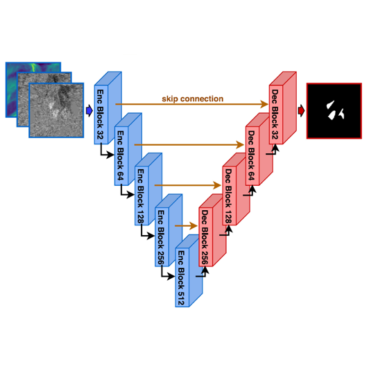
Machine learning is a collection of methods that use mathematics, statistics and informatics to teach computers how to discover hidden patterns and relations by analysing big or small datasets. As part of the field of artificial intelligence, machine learning has entered and transformed all fields of society, including how we use drones and satellites to monitor and map the Earth.

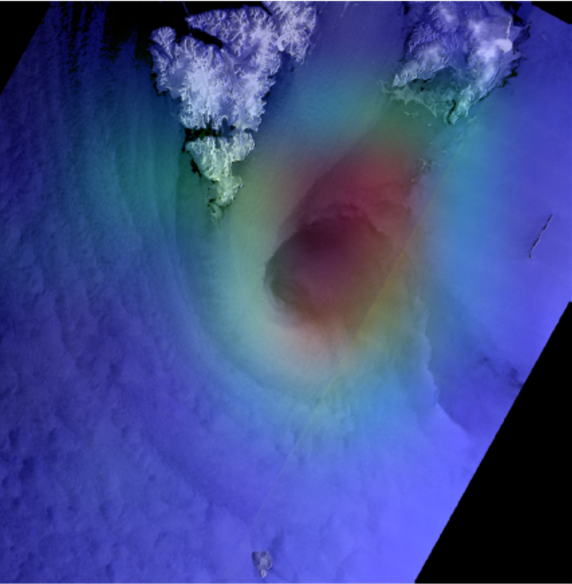
In earth observation from drones and satellites, machine learning is used to automize the analysis of images and measurement data. One example of what we do at NORCE is to develop computer programs that detect avalanches in satellite images and predict the risk of new ones from available satellite images – without any need for human interpretation. We also research how machine learning can extract information about polar lows and predict where and when these westbound cyclone systems will hit the Norwegian coast. Another focus area is to extract information about offshore windfarms, where they should be placed, and how they can be managed most efficiently.

Polar low detection, ,

Explainable AI

Automatic interpretation of a satellite image from the Barents Sea. The warm colours overlaid on the image is a so-called heat map, which points out parts of the image that are responsible for the decision of labelling this as a polar low. Figure: Jakob Grahn, NORCE.

Modern machine learning makes frequent use of computer models of the human brain – so-called artificial neural networks. These have brought about some of the biggest and best-known advances in artificial intelligence in recent years. To enable new steps forward, it is important to combine these “artificial brains” with models of nature and the laws of physics. It is particularly in this cross-disciplinary intersection that NORCE has its expertise: We know both machine learning, the measurement principles of the sensors that fly on satellites and drones, and the physics that described the medium that is observed – whether it be ocean or land, ice or snow.

Avalanche network square, ,

Computational structure

Artificial neural network that processes radar satellite images and digital elevation maps and segments out areas containing rubble from an avalanche. Figure: Jakob Grahn, NORCE.

Meet the scientists

Jakob Grahn

Senior Researcher - Tromsø
jgra@norceresearch.no

+47 462 86 095

Thomas Johansen

Senior Researcher - Tromsø
thjo@norceresearch.no
+47 56 10 78 42

Stian Normann Anfinsen

Senior Researcher - Tromsø
stia@norceresearch.no
+47 56 10 78 43
+47 906 56121 (mobile phone)

Jonas Nordhaug Myhre

Senior Scientist - Tromsø
jonm@norceresearch.no
+47 56 10 78 51

Related research groups:

Earth Observation
Earth Observation