Go straight to content
<
<
Earth Observation

Earth Observation

Advanced Technology for Remote Sensing

NORCE is one of Norway's leading research institutes in earth observation (EO) from satellite, with a unique expertise that spans across information technology, satellite data processing, and physical understanding of sensors, signals, and the observed media. The EO activities consist of 20-25 scientists, with main focus on SAR (Synthetic Aperture Radar) processing and applications.

The EO group has about 15 scientists and works on a wide range of projects including SAR processors, interferometry, precision geocoding, SAR data simulation, as well as applications including monitoring and mapping of snow and avalanches, vegetation monitoring, permafrost, oceanography, and the use of machine learning for change and object detection.

Contact person
Kjell Arild Høgda

Earth Observation Research Director Earth Observation - Tromsø

kjho@norceresearch.no

+47 934 18 859

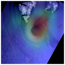
Polar low detection, ,

The Earth Observation Group Consists of Around 15 researchers

The Earth observation group is working on development of new advanced technology for remote sensing, at the same time as we are involved in numerous projects where this technology is applied. This gives us a unique opportunity to contribute to our partners with technology at the forefront of research in the projects we participate in. Our specialty is the processing of SAR (synthetic aperture radar) images going all the way from the raw data stream from the satellite to advanced applications.

Technology Development

SAR processing: Synthetic Aperture Radar (SAR) is a radar that uses microwaves to image the earth's surface. The spatial resolution of a radar image is among other things depending on the size of the radar antenna. A SAR uses advanced computing to provide better spatial resolution than the physical dimensions of an antenna would suggest. However, this requires advanced signal processing technology and advanced processors. NORCE is at the forefront of research in the field and makes SAR processors for both ESA and national players. A further development of the SAR technique is interferometric measurements (InSAR), where phase shifts in the received signal are used to measure small movements and displacements in the earth's surface with millimetre accuracy. We develop InSAR processing systems and visualization tools that contribute to operational mapping services. NORCE has e.g. developed the national system for measuring ground movements (INSAR.NGU.NO) and is now working with partners to develop a similar system at European level. Contact persons: Temesgen Gebrie Yitajew, Yngvar Larsen

Machine learning: Artificial intelligence has taken an important role also within the fields of satellite remote sensing and earth observation. NORCE has solid competence on contemporary methods from machine learning, such as deep neural network architectures, reinforcement learning and computer vision algorithms. We combine theoretical knowledge on these methodologies with practical experience with earth observation applications. Our strength is the ability to combine methodological expertise with domain knowledge from earth observation. This enables us to design new methods and solutions that are adapted to the problem and incorporate prior knowledge of the underlying physics. Examples of tasks where we have used deep learning include ship detection, vegetation mapping, avalanche detection and prediction, and offshore wind estimation. Contact person: Stian N. Anfinsen

Space debris: Space debris is man-made objects in space that no longer serve any purpose. They span sizes from entire launchers to dust particles, and there are hundreds of thousands of such objects in orbit around the earth, even if we only count objects from one cm and upwards. As they move at extremely high speeds, even small particles carry a large amount of energy, and collisions with such particles pose a danger to all human activities in space, both manned and unmanned. At NORCE, we develop technology to monitor space debris using radar instruments. Such monitoring is important to avoid collisions that could destroy active satellites and endanger astronauts' lives, but also to build knowledge about how the debris behaves over time and how the total amount of debris develops over time. Contact person: Tom Grydeland
  • We are developing a methodology for detecting and warning of avalanches for use over large areas, based on artificial intelligence and data from the Sentinel-1 satellites.
  • We use radar and laser altimetry data (e.g. CryoSat-2, ICESat-2) for monitoring the snow and ice cover.
  • The polar regions are a hot spot of climate change. Satellite altimetry is used to measure surface elevations and to estimate the volume of marine and terrestrial ice masses.

Applications

Avalanche detection: Every year avalanches take lives, block roads and destroy expensive infrastructure. We are developing a methodology for detecting and warning of avalanches for use over large areas, based on artificial intelligence and data from the Sentinel-1 satellites. Our tools can be used globally and are currently used by both NVE and ESA for mapping avalanches. Contact person: Jakob Grahn

Detection of polar lows: Polar lows are intense maritime cyclones characterised by rapid development, small scale, fierce winds, and heavy snowfall. This makes them both difficult to predict and very hazardous. We research detection and early forecasting of polar lows, based on high resolution satellite data and deep learning. Contact person: Jakob Grahn

Snow and ice-cover mapping: Snow cover is an important climate parameter and NORCE has in decades developed methods to monitor the snow cover. We use optical and SAR sensors combined with advances processing to measure the snow cover. A main focal point has been to include radar satellites since we often work in polar regions where polar night and cloudy conditions severely limits the use of optical satellites. We also develop methods for monitoring ice on rivers, lakes and sea ice. Contact person: Eirik Malnes

Snow water equivalent: To measure the snow water equivalent or depth is very useful in connection with climate, hydropower and avalanche monitoring. NORCE apply a broad spectrum of sensors (satellite, aircraft, drone and fibre cables) to develop the technology. The aim is that various sensor combinations combined with artificial intelligence can provide detailed and high resolutions snow water equivalent products. Contact person: Eirik Malnes

Surface water, soil moisture and tidal sones: SAR is a useful instrument for monitoring changes in surface water (flood or variable water levels in lakes) or soil moisture and freeze/thawing state of soils. NORCE works with these applications in several projects linked to climate change, extreme events (e.g. soil/quick clay landslides) or hydrological service development. NORCE have also mapped the tidal sones of Norway. Contact persons: Eirik Malnes, Jörg Haarpaintner

Vegetation applications: The Arctic is among the areas where climate change first appears and will have the strongest impact. We have many decades of experience in analysing satellite images for mapping of vegetation and vegetation damage. Studies of long time series of optical satellite data for measuring the growing season (phenology) and the effects of climate change on the growing season are also an important activity. Contact persons: Kjell Arild Høgda, Stein Rune Karlsen

Permafrost and geohazard applications: Climate change leads to permafrost thawing that can affect the stability of the ground and increase the intensity of hazardous slope processes. Seasonal ground freeze and thaw induces heave and subsidence cyclic patterns, while permafrost degradation and irreversible melt of ground ice leads to long-term subsidence and landform destabilization. We use InSAR to remotely measure ground movement and develop innovative strategies to monitor permafrost variables for polar and mountain areas. Contact persons: Line Rouyet, Tom Rune Lauknes

Satellite altimetry in polar regions: The polar regions are a hot spot of climate change. Satellite altimetry is used to measure surface elevations and to estimate the volume of marine and terrestrial ice masses. We use radar and laser altimetry data (e.g. CryoSat-2, ICESat-2) for monitoring the snow and ice cover. The results can, for example, be used to improve the parameterization of climate models and study the effects of climate change. Contact person: Robert Ricker

Operational use of InSAR: We operationally use the InSAR technology we have developed e.g. to detect, characterize and monitor landslides, permafrost landforms and glaciers. On infrastructure, we use InSAR to identify settlements or complex deformations on buildings, roads, railroads, and dams. Contact persons: Tom Rune Lauknes, Line Rouyet, Yngvar Larsen, Jelte van Oostveen

Oceanography: Wind, waves and currents over the ocean can be observed by SAR satellites. A SAR image is a snapshot of the sea surface, which provides information regarding the wind speed, ocean swell and significant wave height, aa well as the radial velocity of the current. The observations have a relatively good resolution, cover large areas and can be used in oil spill detection, drift modelling of icebergs, situational awareness for fish farms and other aquaculture installations, weather modelling, and in offshore wind applications. Contact person: Heidi Hindberg

Offshore wind: Offshore wind is believed to be one of the most important components in the green shift. SAR is a unique source for high-resolution observations of the wind at sea level. In our work, we focus on improving wind products for coastal areas, where both numerical models and existing SAR wind products have weaknesses. In this work, we combine our expertise in SAR oceanography and numerical modelling of wind and waves with expertise in machine learning and deep neural networks. Contact persons: Heidi Hindberg, Stian N. Anfinsen

Ice-dynamic and glaciology: The world’s glaciers and ice sheets are key indicators of ongoing climate change. With satellite remote sensing, we have the possibility to monitor the health and status of these glaciers and ice sheets during day and night, all year around. Currently, we have projects on ice dynamics (surface velocities, grounding lines, calving fronts and geodetic mass balance) of Svalbard glaciers and ice shelves in Antarctica. Contact person: Jelte van Oostveen

Sustainable development / cooperation with developing countries: The UN's goal for sustainable development is the United Nations' joint work plan to eradicate poverty, fight inequality and stop climate change by 2030. Earth observation plays an important role and in several projects we contribute with SAR technology to increase the competence of partners in Africa. We work towards improving, for example, mapping of forests and forest change (REDD), area types, and environmental changes around refugee camps. Contact person: Jörg Haarpaintner

Meet the Team

Kjell Arild Høgda

Research Director Earth Observation - Tromsø
kjho@norceresearch.no

+47 934 18 859

Eirik Malnes

Chief Scientist - Oslo
eima@norceresearch.no

+47 917 58 213

Stian Normann Anfinsen

Senior Researcher - Tromsø
stia@norceresearch.no
+47 56 10 78 43
+47 906 56121 (mobile phone)

Jelte van Oostveen

Researcher - Tromsø
jeoo@norceresearch.no
+47 56 10 78 41
+47 468 24 226

Robert Ricker

Senior Scientist - Tromsø
rori@norceresearch.no
+47 56 10 78 40

Tom Grydeland

Senior Researcher - Tromsø
tgry@norceresearch.no

+47 452 21 330

Geir Engen

Senior Researcher - Oslo
geen@norceresearch.no

+47 995 17 285

Harald Johnsen

Chief Scientist - Tromsø
hjoh@norceresearch.no

+47 951 73 353

Heidi Hindberg

Senior Researcher - Tromsø
hehi@norceresearch.no

+47 478 37 083

Jakob Grahn

Senior Researcher - Tromsø
jgra@norceresearch.no

+47 462 86 095

Line Rouyet

Senior Researcher - Tromsø
liro@norceresearch.no

+47 405 52 235

Temesgen Gebrie Yitayew

Senior Researcher - Tromsø
teyi@norceresearch.no

+47 410 68 101

Jörg Haarpaintner

Senior Researcher - Tromsø
jrha@norceresearch.no

+47 470 70 341

Tom Rune Lauknes

Senior Researcher - Tromsø
tlau@norceresearch.no

+47 918 58 817

Yngvar Larsen

Senior Researcher - Tromsø
ynla@norceresearch.no

+47 907 91 839

Stein Rune Karlsen

Senior Researcher - Tromsø
skar@norceresearch.no

+47 934 19 904

See all projects

Related Stories

See all news